Hurricane Info Links
Compiled by
|
| Atlantic
Overview Overview Page Provides Best Access to Individual Storm Graphics Such as Forecast Paths. TIP! Tap Storm Icons for Projected Storm Track |
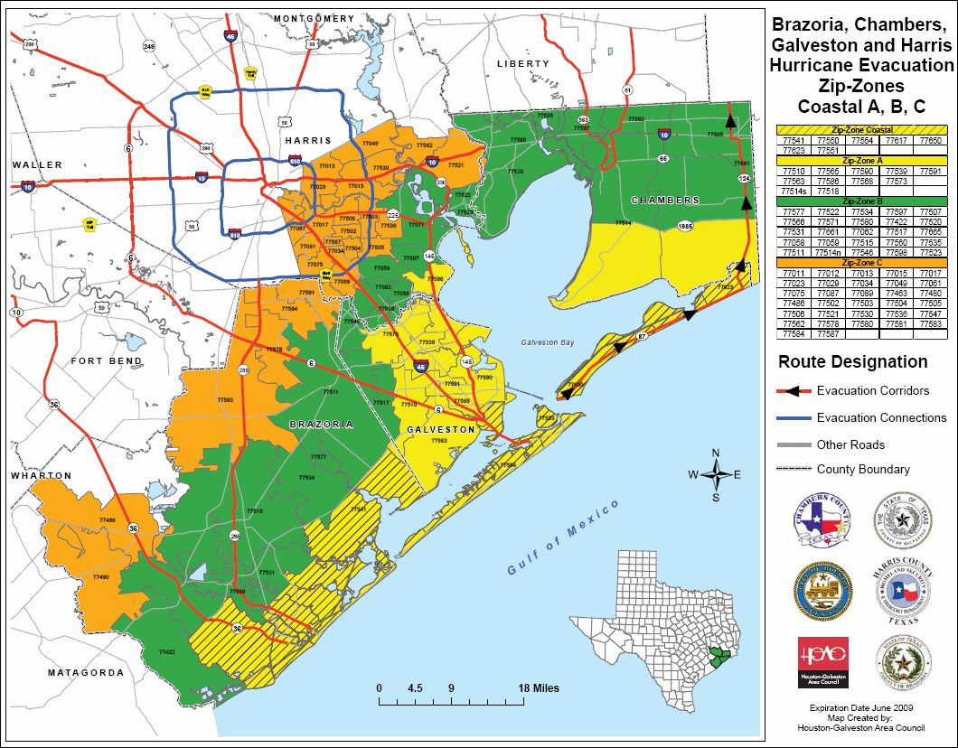
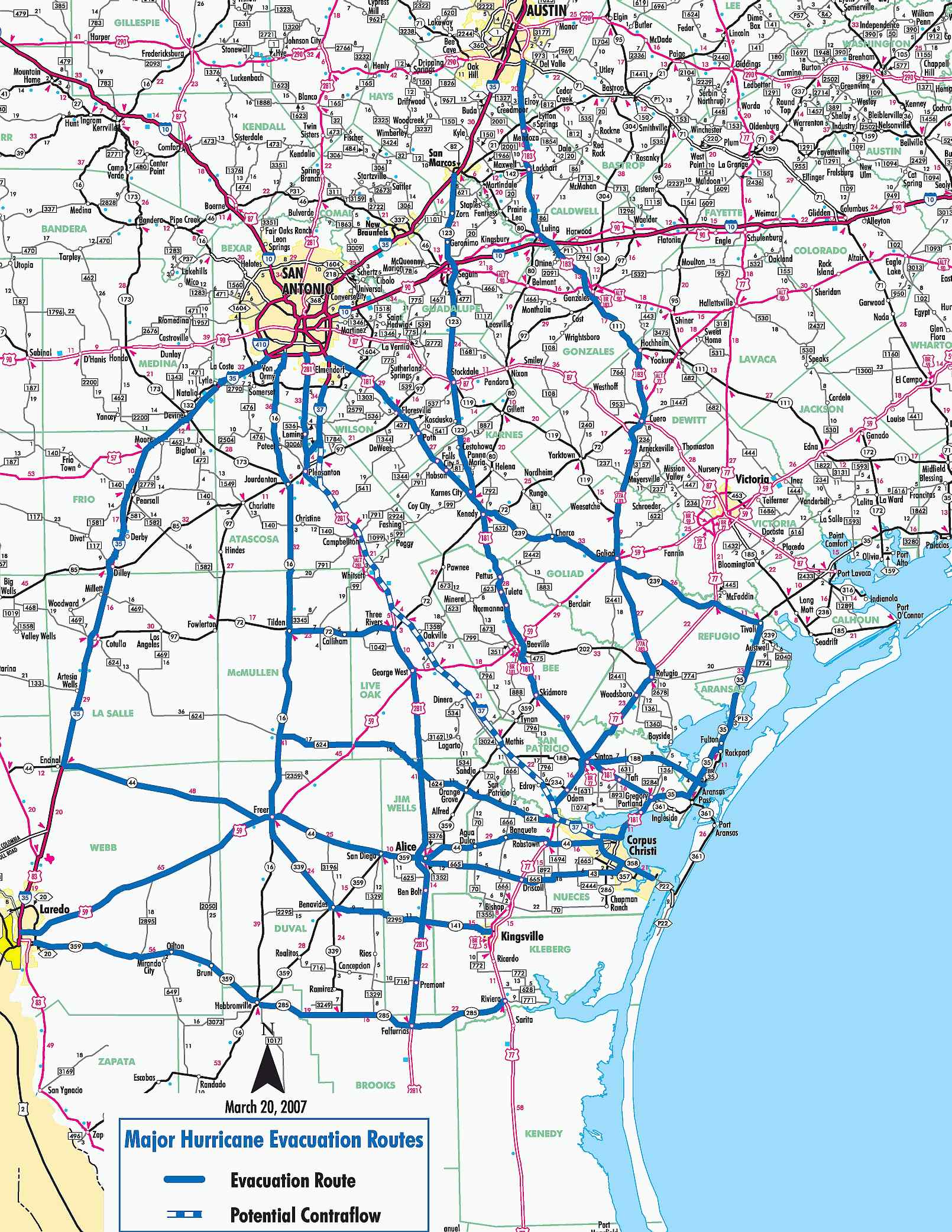
| Texas Costal Evacuation Routes (BlueWhite = Contraflow) Houston Houston TransStar Yoakum Corpus Christi Pharr (Maps are 350-800k) |
| Google.Org Crisis Map Good graphics, storm track, weather, routes, evac centers, waze alerts |
| NE Coast Evacuation Routes No Reasonable References Found, Use Google.Org Crisis Map |
| Current Storm Info |
| Hurricane Info "Text Only" |
| USA Water Vapor (new) |
| Local
WX Forecasts (Tip! click "Forecast Discussion") |
|
|
| Crown Tropic |
|
|
|
|
|
|
Count: